alaska-maps
Create maps in R for showing site locations in Alaska. Works for other locations too.
View the Project on GitHub ocean-satellite-tools/alaska-maps
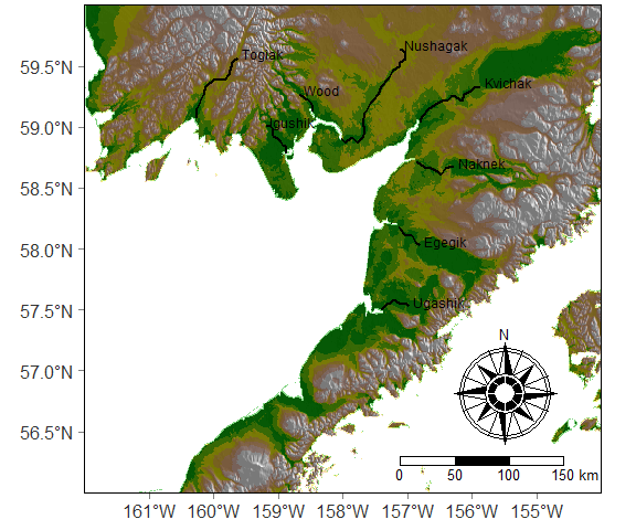
Elevations.Rmd (rmd view) shows how to create this map using just the raster and tmap packages. All the spatial data is also from those packages. You don’t need to download any extra files. The Rmd file alson includes an example (at the bottom) of adding an inset to show the study location within Alaska.